柯克比
旅遊指南
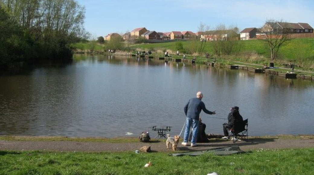

暢遊柯克比

利物浦鐵達尼號酒店
Stanley Dock, Regent Road Liverpool England
6月28日 至 6月29日 價格為每晚 HK$1,009
HK$1,009
合共 HK$1,236
6 月 28 日 - 6 月 29 日
連稅及其他費用
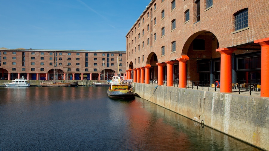
歡迎在利物浦入住此商務酒店。這裡備有免費 Wi-Fi、早餐 (收費)及24 小時客房送餐服務任你盡享。在我們收到的評價中,旅客都讚賞這裡的餐廳及熱心員工。亞伯特皇家船塢及晏菲路球場等熱門景點就在附近。
9.4/10 完美! (2,272 則評價)
"I really like this hotel. However the gym is only open 6am-8pm. This is a problem for business travellers who often have less time to use the facilities. Because of this I will choose a different hotel for my next trip to Liverpool"
評價日期:2026 年 6 月 24 日

達雷斯伯里公園酒店
Daresbury Park Warrington England
6月26日 至 6月27日 價格為每晚 HK$509
HK$509
合共 HK$611
6 月 26 日 - 6 月 27 日
連稅及其他費用
歡迎在瓦令頓入住此商務酒店。這裡備有免費泊車、早餐 (收費)及健身俱樂部任你盡享。Arley Hall 古蹟別墅及諾頓修道院博物館等熱門景點就在附近。
9/10 卓越! (152 則評價)
"The hotel was clean,fresh & modern looking with excellent facilities. Comfortable beds & pillows. Was a little bit too hot in room & you couldn't open the windows any further due to the restraint at the bottom of the window. Some sort of air conditioning or fan would be nice especially n the room ..."
評價日期:2026 年 6 月 23 日

利物浦市Maldron酒店
2 Park Lane Liverpool England
6月28日 至 6月29日 價格為每晚 HK$690
HK$690
合共 HK$853
6 月 28 日 - 6 月 29 日
連稅及其他費用
歡迎在利物浦入住此酒店。這裡備有健身設施、24 小時接待處及3 間會議室任你盡享。晏菲路球場及利物浦 ONE等熱門景點就在附近。
9.2/10 卓越! (1,050 則評價)
"Good location , good service. Definitely will come again"
評價日期:2025 年 12 月 6 日
過去 24 小時內找到的最低每晚價格 (2 位成�人 1 晚)。價格及供應情況可能會出現變動。可能設有其他條款。

利物浦馨樂庭市中心酒店
72 Church Street Liverpool England
歡迎在利物浦入住此商務服務式住宅。這裡備有免費 Wi-Fi、早餐 (收費)及健身設施任你盡享。在我們收到的評價中,旅客都讚賞這裡的熱心員工及整潔客房。亞伯特皇家船塢及晏菲路球場等熱門景點就在附近。
9.4/10 完美! (1,252 則評價)
"Brilliant. The reception girl is so nice! Very hot welcoming. She’s so lovely, with room upgrade."
評價日期:2026 年 6 月 3 日

西德尼街8號度假屋
8 Stanley Street Liverpool England
歡迎在利物浦入住此服務式住宅。這裡備有免費 Wi-Fi及客房清潔服務任你盡享。亞伯特皇家船塢及晏菲路球場等熱門景點就在附近。
9.2/10 卓越! (14 則評價)
"I had a really good stay. Great price, clean and well set out room. The staff were really friendly and helpful. My first choice now for any future Liverpool trips."
評價日期:2026 年 6 月 23 日

Hy 利瑟姆聖安妮斯酒店
318-328 Clifton Drive North, 318-328 Lytham St. Anne's England
歡迎在萊薩姆聖安納斯入住此豪華服務式住宅。這裡備有免費 Wi-Fi、免費泊車及全方位 SPA任你盡享。在我們收到的評價中,旅客都讚賞這裡的熱心員工及住宿整體狀況。黑池遊樂海灘及黑池海灘等熱門景點就在附近。
過去 24 小時內找到的最低每晚價格 (2 位成人 1 晚)。價格及供應情況可能會出現變動。可能設有其他條款。
熱門景點


當地玩樂


Expedia 帶你探索旅遊世界
- 安菲爾德 3 星級酒店
- 安特里的民宿
- 安特里賽馬場附近的酒店
- 安菲爾德的提供 Wi-Fi 的酒店
- 安菲爾德的Spa 酒店
- 安菲爾德的婚禮酒店
- 安菲爾德酒店
- 晏菲路球場附近的酒店
- 唐人街附近的酒店
- 克羅斯比酒店
- 格魯吉亞區酒店
- 葛迪遜公園附近的酒店
- 諾斯利區酒店
- 克諾斯里大廳附近的酒店
- 諾斯利野生動物園附近的酒店
- 利物浦的觀光農場
- 利物浦的出租公寓
- 利物浦的民宿
- 利物浦的露營車園區
- 利物浦的共管公寓
- 利物浦的鄉間房屋
- 利物浦的旅館
- 利物浦的附設酒吧的酒店
- 利物浦的娛樂場酒店
- 利物浦的親子酒店
- 利物浦的浪漫酒店
- 利物浦的婚禮酒店
- 利物浦酒店
- 利物浦的船屋
- 默西賽德郡酒店
- 新布萊頓酒店
- 雷恩希酒店
- 聖海倫酒店
- 史丹利碼頭菸草倉庫附近的酒店
- 利物浦大學附近的酒店
- 沃克斯豪爾酒店
- 安特里賽馬場
- 前往安特里
- 晏菲路球場
- 安菲爾德假期
- 前往伯肯赫德
- 布隆德沙海灘
- 前往布拖勒
- 洞穴俱樂部
- 克羅斯比海灘
- 克羅克斯泰思莊園和郊野公園
- 克羅克斯泰斯廳和鄉村公園
- 邊山大學
- 葛迪遜公園
- 前往海頓
- 諾斯利野生動物園
- 前往雷森
- 利物浦球隊博物館及導賞中心
- 前往安菲爾德
- 前往波羅的海三角
- 利物浦大教堂
- 利物浦中央圖書館
- 利物浦市中心假期
- 前往克羅斯比
- 利物浦帝國劇場
- 前往埃弗頓
- 前往福姆比
- 前往格魯吉亞區
- 前往諾斯利
- 前往利物浦市中心
- 前往馬格爾
- 利物浦大都會教堂
- 前往新布萊頓
- 前往古老天鵝
- 利物浦 ONE
- 前往陽光港
- 前往雷恩希
- 前往塞夫頓公園
- 前往斯皮克
- 前往聖喬治區
- 前往沃克斯豪爾
- 前往滑鐵盧
- 利物浦假期
- 前往利物浦
- 梅西塞德海事博物館
- 默西賽德郡假期
- 前往普萊斯考特
- 皇家利物浦大學醫院
- 前往斯卡里斯伯里克
- 聖喬治大廳
- 前往聖海倫
- 皇家劇院
- 利物浦大學
- 華克畫廊
- 前往沃拉西
- 前往威德內斯
- 前往在馬克菲爾德的艾希頓
- 威廉姆森隧道遺產中心
- 利物浦世界博物館

